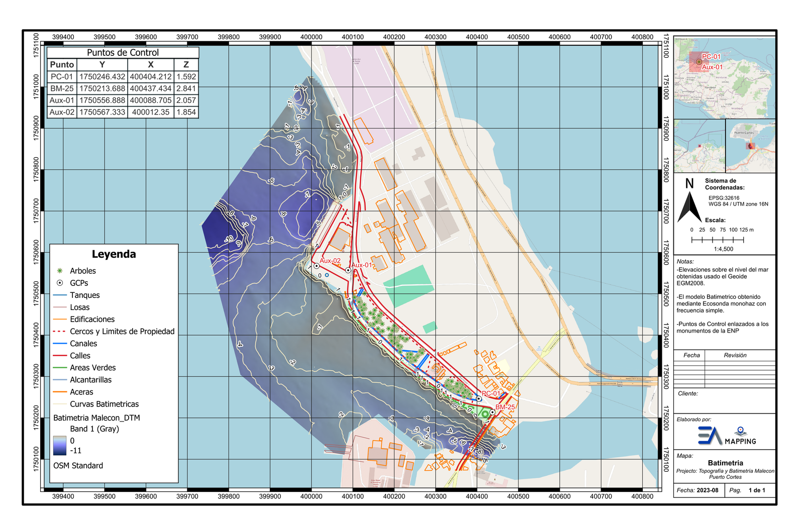
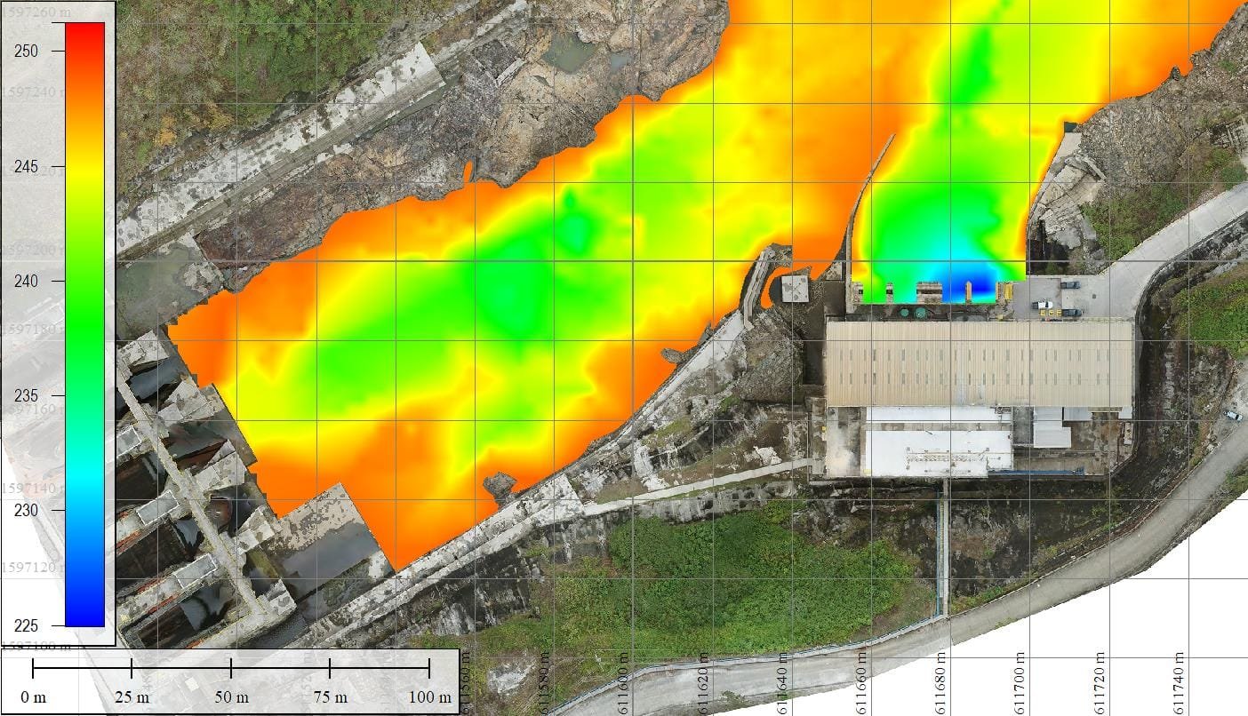
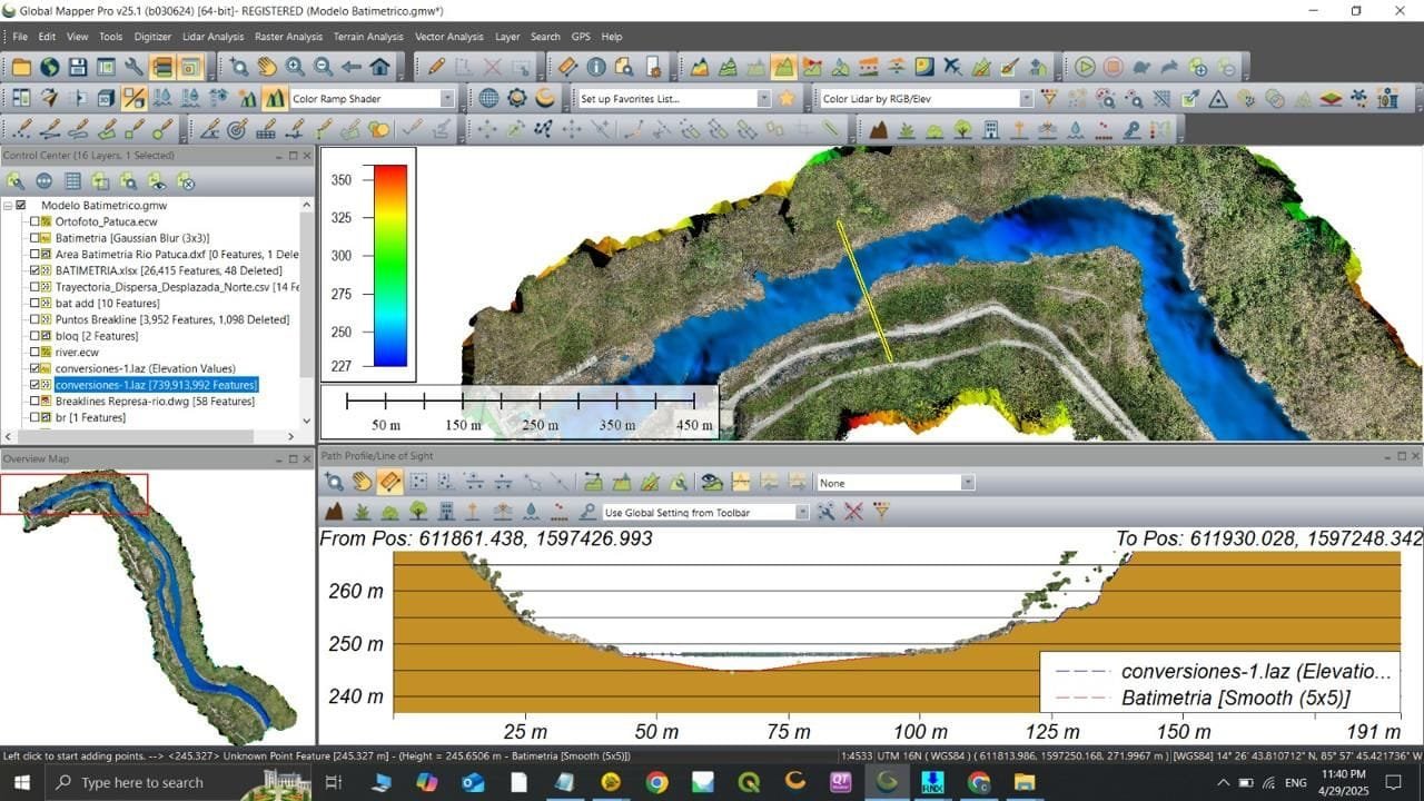
Service

Bathymetric Survey

Precision underwater terrain mapping using single-beam and multi-beam sonar systems for lakes, rivers, canals, estuaries, and coastal waters. Florida's extensive waterway network demands accurate sub-surface data for dredging design, flood control modeling, sediment management, and marine construction — we deliver it with survey-grade accuracy.

Bathymetric Survey

What Is a Bathymetric Survey?

A bathymetric survey measures and maps the depth and underwater topography of a water body. Using acoustic transducers (sonar), our survey vessel transmits sound pulses and records the return time to calculate depth at thousands of points per minute. Combined with precise GNSS positioning, every depth measurement is georeferenced and integrated into a continuous underwater terrain model.

EA Mapping integrates bathymetric surveys with terrestrial topographic data to create seamless above-and-below-water surface models — essential for flood routing, hydraulic modeling, dredging volume calculations, and coastal infrastructure design.

What You Receive

  • Bathymetric map with depth contours and soundings (PDF + DWG)
  • 3D underwater terrain model (TIN surface) for hydraulic modeling
  • Sediment volume and capacity calculations for dredging design
  • GIS dataset (shapefile, GeoPackage) compatible with ArcGIS and QGIS
  • Seamless topo-bathy surface merging land and underwater data
  • NAVD88-referenced vertical datum with tide correction report

Common Use Cases

  • Dredging design and pre/post-dredge volume verification
  • Marine and waterfront construction — piers, seawalls, bridges
  • Flood control modeling and stormwater retention pond assessment
  • Sediment accumulation monitoring in retention and treatment ponds
  • Port, marina, and navigation channel condition surveys
  • Aquifer and reservoir capacity studies for water management

Work Samples

Bathymetric Elevation Map
Bathymetric Data in Global Mapper

Left: color-coded depth map from sonar data. Right: bathymetric surface processing in Global Mapper.

Ready to get started?

Tell us about your project and we'll respond within 24 hours.

Request a Quote