Service
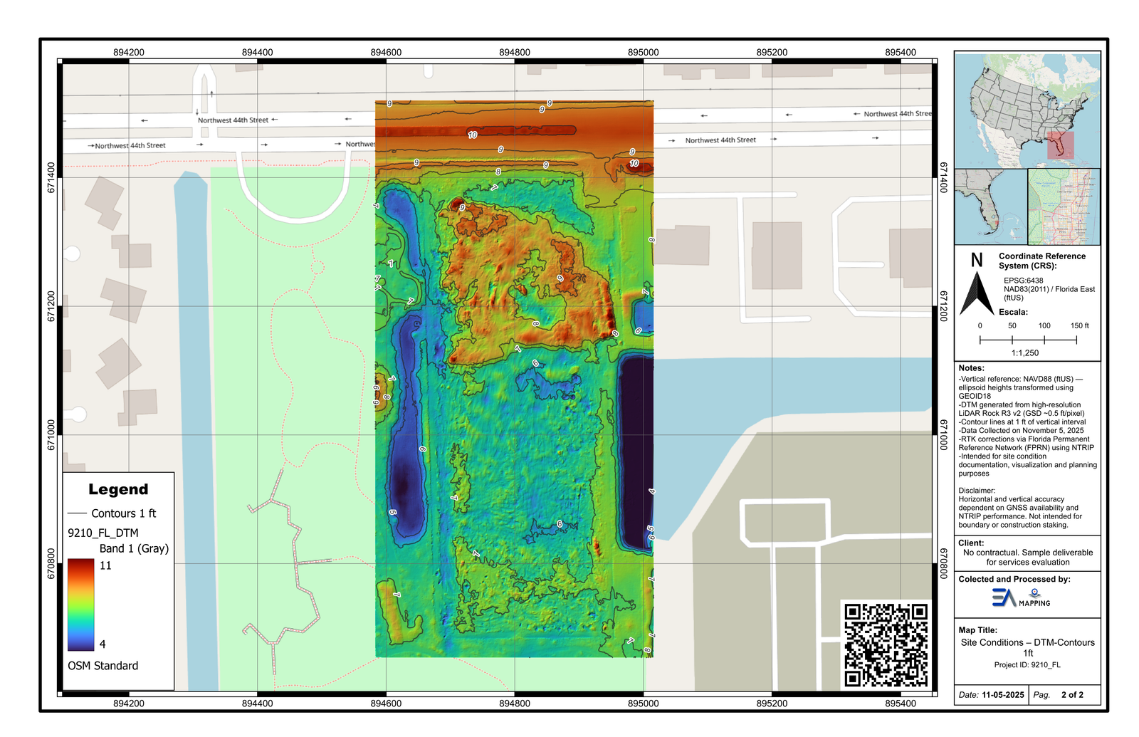
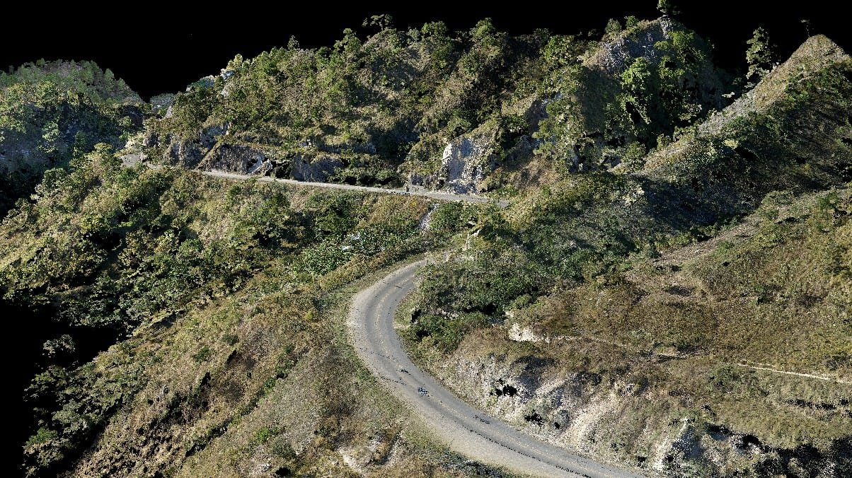
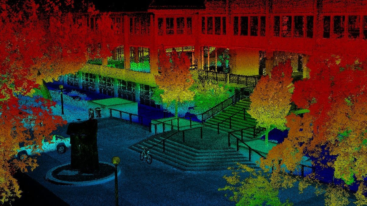
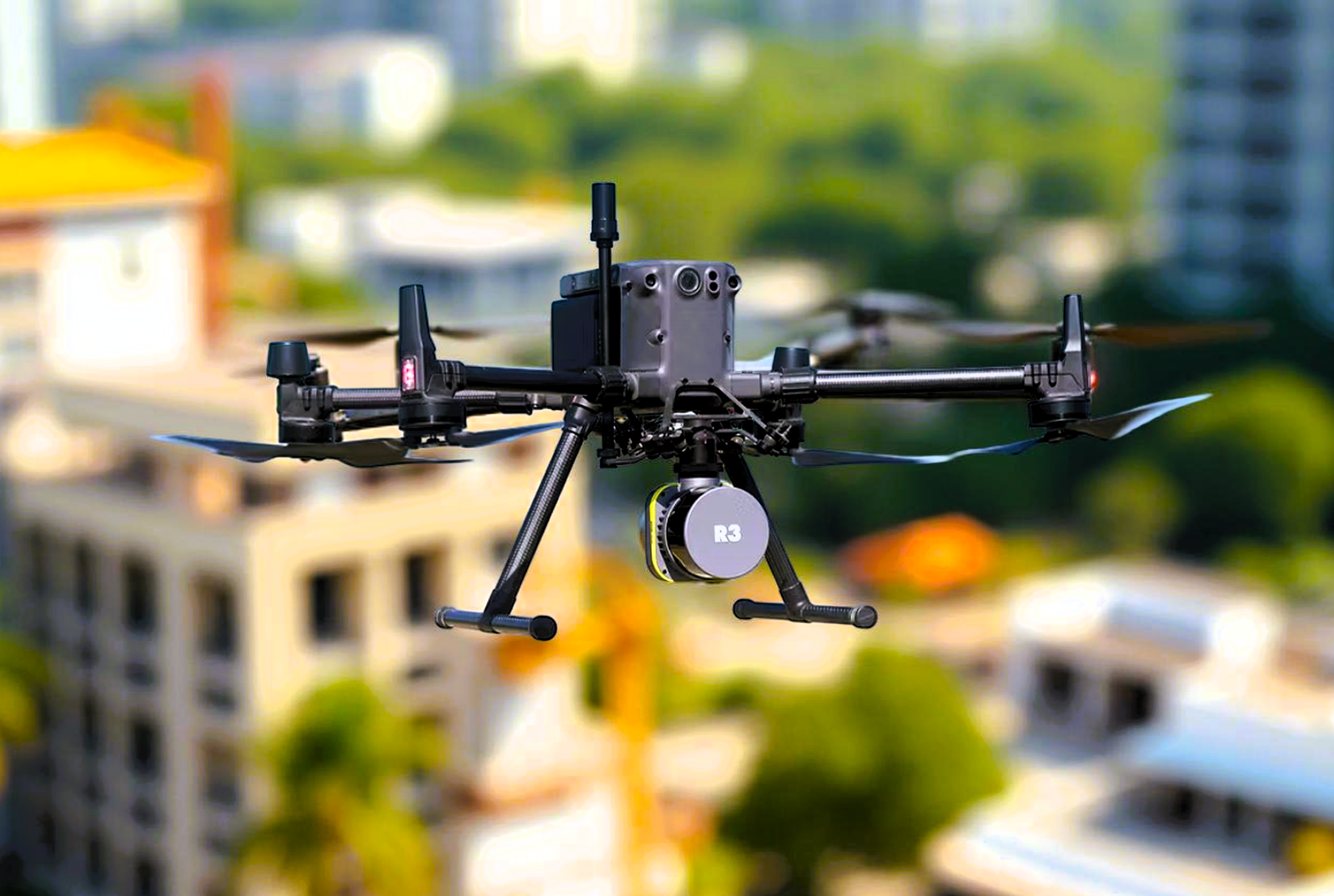
High-density 3D point clouds captured via aerial UAV, mobile vehicle-mounted, or terrestrial static LiDAR systems. Where conventional survey methods would take weeks, LiDAR delivers millions of precise elevation measurements per second — covering large corridors, complex infrastructure, and dense urban environments in a fraction of the time.
Drone-mounted LiDAR scanners for large-area terrain mapping. Ideal for sites up to hundreds of acres. Penetrates vegetation to capture bare-earth DTMs. Fast mobilization, no ground crew required for most acquisitions.
Vehicle-mounted SLAM LiDAR for road corridors, utility infrastructure, and urban streetscapes. Captures complex roadway geometry, signage, and features at highway speeds. Ideal for DOT projects and corridor assessments.
Tripod-mounted phase or time-of-flight scanners for as-built documentation, structural inspection, and confined environments. Sub-millimeter accuracy for bridges, buildings, retaining walls, and industrial facilities.
Left to right: road corridor point cloud, urban SLAM scan, UAV-mounted LiDAR payload.