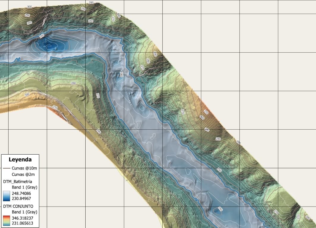
Service

Topographic Survey

Precision elevation data and contour mapping that forms the foundation of every engineering, drainage, and site development project. We capture ground truth — exact elevations, terrain features, and surface geometry — so your engineers can design with confidence from the first submission.

Topographic Survey

What Is a Topographic Survey?

A topographic survey measures and maps the elevation and physical features of a site — including terrain contours, drainage patterns, existing structures, trees, utilities, and other surface improvements. The result is a highly accurate 2D or 3D representation of the land that engineers, architects, and contractors use to plan, design, and permit development projects.

EA Mapping performs topographic surveys using high-precision GNSS receivers, robotic total stations, and UAV-based photogrammetry, delivering data in formats ready for Civil 3D, Bentley, and GIS platforms.

What You Receive

  • 2D topographic map with 1-ft or 2-ft contour intervals
  • 3D Digital Terrain Model (DTM) and surface mesh
  • LandXML surface file for Civil 3D import
  • DWG/DXF CAD file with feature layers and spot elevations
  • PDF exhibit map stamped by Florida Licensed Surveyor
  • NGVD29 / NAVD88 vertical datum report

Common Use Cases

  • Stormwater and drainage design — required by SFWMD and FDEP permitting
  • Pre-construction site grading and earthwork planning
  • SWPPP and erosion control design
  • Cut-fill analysis and mass grading optimization
  • Wetland boundary and floodplain delineation support
  • Site feasibility studies and due diligence for land acquisition

Work Sample

DTM Contour Map from LiDAR data

LiDAR-derived DTM with contour overlay — typical deliverable for drainage and grading design.

Ready to get started?

Tell us about your project and we'll respond within 24 hours.

Request a Quote